Find Jobs
Hire Freelancers

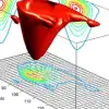
Create x,y,z mesh plot over city map boundaries.

$250-750 USD

En curso
Publicado hace alrededor de 10 años

$250-750 USD

Pagado a la entrega
Need to overlay a data over several cities. I want to do an animation of a mesh plot. Perhaps using Matlab software to create the movie. However, we need to be able to overlay the x,y,z meshplot over a map with city geographical boundaries. The boundaries may be taken from google API or something similar.
ID del proyecto: 5902149

Información sobre el proyecto

12 propuestas
Proyecto remoto
Activo hace 10 años

¿Buscas ganar dinero?

Beneficios de presentar ofertas en Freelancer

Fija tu plazo y presupuesto
Cobra por tu trabajo
Describe tu propuesta
Es gratis registrarse y presentar ofertas en los trabajos
12 freelancers están ofertando un promedio de $379 USD por este trabajo
Avatar del usuario
A proposal has not yet been provided
$526 USD en 10 días
5,0 (135 comentarios)
6,5
6,5
Avatar del usuario
I have vast knowledge in Matlab programming. That's why I think I am best candidate for your project. I have done many projects in Matlab perfectly in a timely manner. So I have much experience. Please see my reviews to be assured about my expertise. Regards
$388 USD en 10 días
5,0 (42 comentarios)
5,5
5,5
Avatar del usuario
Hi, I'm a computer scientist doing my PhD. How many cities are in this project? If it's humanly possible, we can make images of each city with a draw boundary and just put the info over the image of each city, this is a simple way to do it. Anyway, other approaches can be considered. I have a lot of experience in matlab and handling meshes. I already made a video of one simulation of heat dissipation over a mesh in matlab. If you want I can send you the video file. I'm dont know if you need this done fast but I would like to take this job and have the time to do it right, I don't like things half done. So, contact me if you want. Best regards.
$250 USD en 15 días
5,0 (6 comentarios)
4,5
4,5
Avatar del usuario
Dear sir I am pursuing PhD in the area of computational mechanics and published 5 international journal papers you can check on the Google. In these paper i have solved partial differential equation by using finite element method and MATLAB. I have a wide experience of mat-lab and mathematics in applied bio mechanics. I am working consultant for BHEL,Makino industries and Hero Motocorp. Looking forward for your early response. Saurabh Kumar Yadav
$250 USD en 10 días
4,6 (16 comentarios)
4,8
4,8
Avatar del usuario
I am an expert in Matlab. I have many experiences in numerical map. I can do it correctly. pls, hire me. I can help you well. Regards.
$250 USD en 5 días
5,0 (11 comentarios)
3,6
3,6
Avatar del usuario
hi, sir, i' m expert in matlab and mathematica i have a lot of experiences in this field. also, i have many experts in matlab field i can help u well. i can do it well and quickly. pls, hire me. best regards.
$250 USD en 3 días
5,0 (17 comentarios)
3,6
3,6
Avatar del usuario
Hi, I have more than 5 years experience in matlab and I have been training others in matlab. I have done mesh plots and animation stuff a hundred times. please let me know more details. we can discuss further. I will always be available on skype for discussions. please let me know by when do you need it. Thanks, Aman
$350 USD en 3 días
5,0 (3 comentarios)
2,6
2,6
Avatar del usuario
I can make this as matlab script with visualization on Google Earth as changes on time. But I don't understand clearly where I can get data about points. I need more details.
$555 USD en 3 días
5,0 (2 comentarios)
2,5
2,5
Avatar del usuario
As a FEM expert.......... We can discuss it .......................................................................................
$250 USD en 10 días
5,0 (1 comentario)
2,2
2,2
Avatar del usuario
Hi, If your x and y are lon/lat coordinates, all that's needed for animation is a simple javascript increment to get the z value (prices?) for a given location over time. If you're mapping for every single town and city in the us, data handled in the browser could be huge (hundreds of megs) and should then be handled server-side. If you're mapping for major cities it could be fine. That can then be styled for each polygon representing city boundaries. This could be done with OpenLayers. The real problem is : 1- getting the boundary data itself free of charge (google API isn't free if you're going to have over 10k requests on it). 2 - for each coordinate, a topological function with JSTS lib has to be called to find what polygon the coordinate belongs to unless.....you have for each x,y value a primary key value such that could be tied to US Census Bureau data (zip code tabulation areas for example). A simpler approach could to plot data on coordinates with a symbolizer (a square, a circle, or whatever)...no polygons, no topological functions, just plain plotting on x/y and styling on z (timelapsed) Anyways, I'm bidding because I think I can be of some help if you can provide boundary data in a well-known text, geojson, kml or shapefile format.
$333 USD en 6 días
0,0 (0 comentarios)
0,0
0,0

Sobre este cliente

Bandera de UNITED STATES
orlando, United States
5,0
4
Forma de pago verificada
Miembro desde oct 16, 2007

Verificación del cliente

¡Gracias! Te hemos enviado un enlace para reclamar tu crédito gratuito.
Algo salió mal al enviar tu correo electrónico. Por favor, intenta de nuevo.
Usuarios registrados Total de empleos publicados
Freelancer ® is a registered Trademark of Freelancer Technology Pty Limited (ACN 142 189 759)
Copyright © 2024 Freelancer Technology Pty Limited (ACN 142 189 759)
Cargando visualización previa
Permiso concedido para Geolocalización.
Tu sesión de acceso ha expirado y has sido desconectado. Por favor, inica sesión nuevamente.